

Heavy Rainfall: Bands of heavy rain clouds could form in Okinawa’s Daitojima region late into the night, raising disaster risks.
- Heavy rain clouds may form in Okinawa’s Daitojima region late Sunday night.
- 180mm of rainfall predicted for Okinawa, 150mm for Amami, and 100mm for Kyushu by Monday noon.
- Public cautioned against landslides, flooding, river overflows, lightning and gusty winds.
- Typhoon Krosa expected to bring high winds, rough seas, and heavy rainfall near Ogasawara Islands Monday to Tuesday.
Severe Weather Conditions Predicted for Okinawa and Surrounding Regions
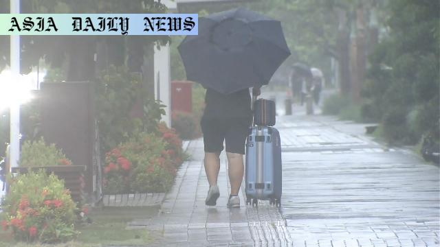
The Japan Meteorological Agency (JMA) has issued a serious weather advisory for Okinawa, Kyushu, and Amami regions as unstable atmospheric conditions prevail. Influenced by a tropical depression and warm, humid air from a high-pressure system, bands of heavy rain clouds are anticipated to form in Okinawa’s Daitojima region late Sunday night. This development significantly heightens the risk of landslides, flooding, and river overflows. Particularly alarming is the forecasted rainfall of up to 180 millimeters in Okinawa by noon Monday, while Amami is set to receive up to 150 millimeters, and Kyushu up to 100 millimeters.
Impacts of Heavy Rainfall on Safety and Infrastructure
This extreme weather situation calls for immediate preparedness to prevent loss of life and minimize property damage. Residents in low-lying areas must stay vigilant as water levels may rise quickly, causing flash floods. The JMA has advised the public to monitor nearby rivers and drainage systems for potential overflow. Additionally, the combination of torrential rains with strong gusts akin to tornadoes poses a serious threat to infrastructure stability such as roadways, bridges, and utility services. Moreover, frequent lightning strikes may disrupt communication networks and pose a risk to personal safety.
Typhoon Krosa Approaches Ogasawara Islands
Compounding the adverse weather patterns is Typhoon Krosa, which is currently moving north at a speed of 20 kilometers per hour near the Ogasawara Islands. Weather officials forecast the storm to reach its closest proximity to the islands between Monday and Tuesday, bringing high winds, torrential rain accompanied by thunder, and perilously high sea waves. The severity of these weather conditions makes it crucial for residents and travelers to exercise caution and adhere to official safety guidelines.
Authorities Urge Vigilance and Safety Measures
Authorities are urging caution against potential lightning strikes and sudden gusty winds, which have the capacity to cause localized damage including uprooted trees, damaged power lines, and scattered debris. Families and individuals are advised to secure outdoor items and avoid unnecessary travel during this period of unstable weather. High waves are an additional concern, particularly for those residing along coastal zones where the risk of flooding is exacerbated by rising tides. Emergency kits and evacuation plans should be readily available for vulnerable populations to manage potential evacuations swiftly.
A Call for Preparedness Amid Ongoing Climate Challenges
This alarming weather forecast underscores the growing vulnerabilities brought about by climate change. Increased atmospheric instability and intensified typhoons have become more frequent in recent years, emphasizing the critical need for enhanced disaster preparedness and resilience. Both local communities and travelers are encouraged to stay updated through official channels and heed all evacuation calls or advisories from weather officials to ensure safety in the coming days.
Commentary
Understanding the Gravity of Heavy Rainfall Risks
The forecast for Okinawa, Amami, and Kyushu brings to light the precarious position many regions face due to unpredictable weather patterns. It is evident that the effects of global warming are manifesting in more extreme rainfall events, which increases the likelihood of disastrous outcomes such as landslides and flash floods. People in affected regions must take these warnings seriously, as the unpredictable nature of such weather systems can lead to severe damage and even casualties. This highlights the necessity of disaster preparedness and localized response systems to mitigate risks.
Lessons from Past Weather Events
While warnings about typhoons and heavy rainfall are not new to Japan, lessons from past events remain crucial. For example, poor drainage systems or improper land use have historically exacerbated the impact of heavy rainfall. Japan’s government and local administrations must continuously review urban planning and infrastructure resilience based on evolving climate risks. Diversifying evacuation protocols and increasing community awareness play an equally important role to reduce the overall vulnerability of the population.
A Call for Global and Local Action
Weather events like these are not limited to one region’s issue but rather serve as a wake-up call for broader climate action. Governments worldwide need to collaborate on reducing environmental impacts that fuel such extreme weather conditions. Local communities, too, have an important role in building resilience, whether by better preparing for emergencies or adapting to new climate realities. The responsibility lies with all of us to ensure a safer, more sustainable future in light of these increasing weather challenges.